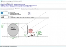
Calculates the angles necessary for installing satellite dishes.
Software tailor made to control your Canon DSLR camera.
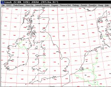
It plots a world map in either azimuth (beam heading) or Mercator projections.
Tracks planet movements, calculates distances providing coordonates of planets.
You can enter your City/State OR Zipcode and it outputs.